|
Last updated
24 August 2012
| |
Courtice
Area Wetlands
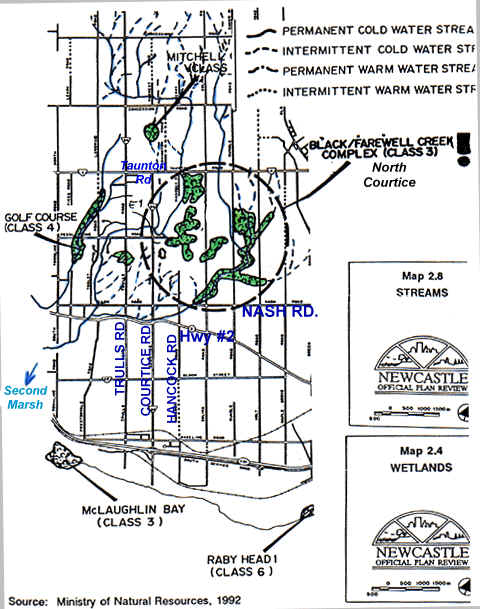
Previously mapped (1992)

New Courtice Wetland Map
MNR August 1999
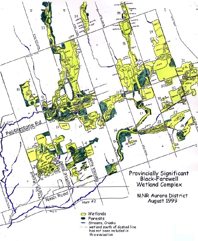
Provincially Significant Black-Farewell
Wetland Complex Map
largest wetland complex in GTA
See the MNR Evaluation (August 1999)
see also Current Events
Map notes
 | West Area (west of Trulls Road) -
not mapped by MNR because of a "Special Study Area" status which requires a
complete, comprehensive watershed study to be done prior to any development taking place
because of natural features and wetland/creek sensitivity.
|
| Glenview (Birchdale) -
is below the dashed line, which was not evaluated by MNR because there is a development
application pending for this area, and MNR was given false information that the
development had already been approved (it has not)
|
| Hancock - logical
extension of wetland (also incorrect information given)
|
| North of Pebblestone -
Outside of Urban Boundary but Trees are being removed
|

Because Council received incorrect info
on the wetland location or it's existence during approval, we respectfully request that
Clarington Council:
Request a review of the OMB
decision on the Hancock neighborhood
That consent from Planning Department
and the owner of Birchdale development land should be sent to MNR to
complete the
evaluation of wetlands in the vicinity of George Reynolds Drive (especially the south
section below the "dashed line")
Ensure that MNR recommendations are
followed and special By-laws are introduced for the protection of wetland functions
[CLOCA Map] [Regional Map] [Water Table Map] [Wetland Map] [Forest Map] [Boundary Map]
|
[Home] [Site Map] [Who We Are] [Black-Farewell] [Black Creek 2001] [Local Wetlands] [What is a Wetland] [Our Watershed] [Map Links] [Current Events] [Studies] [MOEE Tips] [Photo Gallery] [Lake Iroquois] [Responsibility] [Govt. Contacts] [Enviro Links] [Message Forum]
Back to
Map Links
|